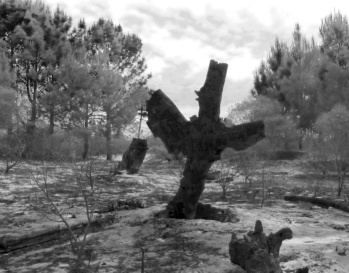
Burned “boo!” tree

An inquisitive old fart with a camera

Monday’s fire persists, but only in a few stumps and with no apparent further danger of spreading.


11 June 2016: This afternoon, walking a slightly different route than normal, I spotted a pine tree starting over — lots of trees were lost to fire several years ago. You have to wonder how much of the existing root system feeds this. Or did it sprout from seed in the rotting trunk? I’ll have to look more closely.

5 May 2017: Pine trees don’t regrow from stumps, unlike eucalyptus trees. But you wouldn’t know that from looking at this. Apparently a pine cone sprouted inside the rotting stump. How it fares as the stump continues to rot will be interesting to watch!

3-½ years later, our hopes of seeing the root structure ended. The rotting host stump burned, consuming the roots of the young tree, now four meters tall.

The dogs were understandably confused yesterday when they encountered something never before seen on the dog walk.


By the end of the walk, we looked back and saw that the brush fire had reached the trees. We were not at all sure we’d have any trees remaining the next morning.

But somehow the fire died down, leaving charred trunks and smoldering stumps today.


The “Boo!” bear stump had already degraded seriously since my photo of it almost three years ago. Not much left of it now.

Some stumps were still aflame. This one has burned underground (note the crater)

Other stumps burned completely, above and below ground, leaving holes.

And strangely, many of the paths we followed were untouched.

Here’s a sapling that was burned in half, but note that the very flammable pine needles nearby were untouched. All in all, very few trees were destroyed.

An ant colony revealed to have been built around branches of a bush.

Overall, a quite surreal experience.

Mexico – January 1, 2009 (southern hemisphere summer): I read Syd’s post about a forest fire which started on the beach side, jumped the Ruta Interbalnearia (main coast road), and did extensive damage to wooded areas on the north side (fortunately not homes, which here are generally not combustible). Three months later we visited, met Syd and Gundy; three more months visited again to check it out in the worst weather; three months later moved. (By the way, Uruguay has been my longest stay in one place since I turned 16 and got my driver’s license!)
Informal loggers moved in, using the excuse of dead trees to remove more than a few perfectly healthy ones. I don’t include in-between imagery because it’s not that good, but clearly shows large areas of dead trees.
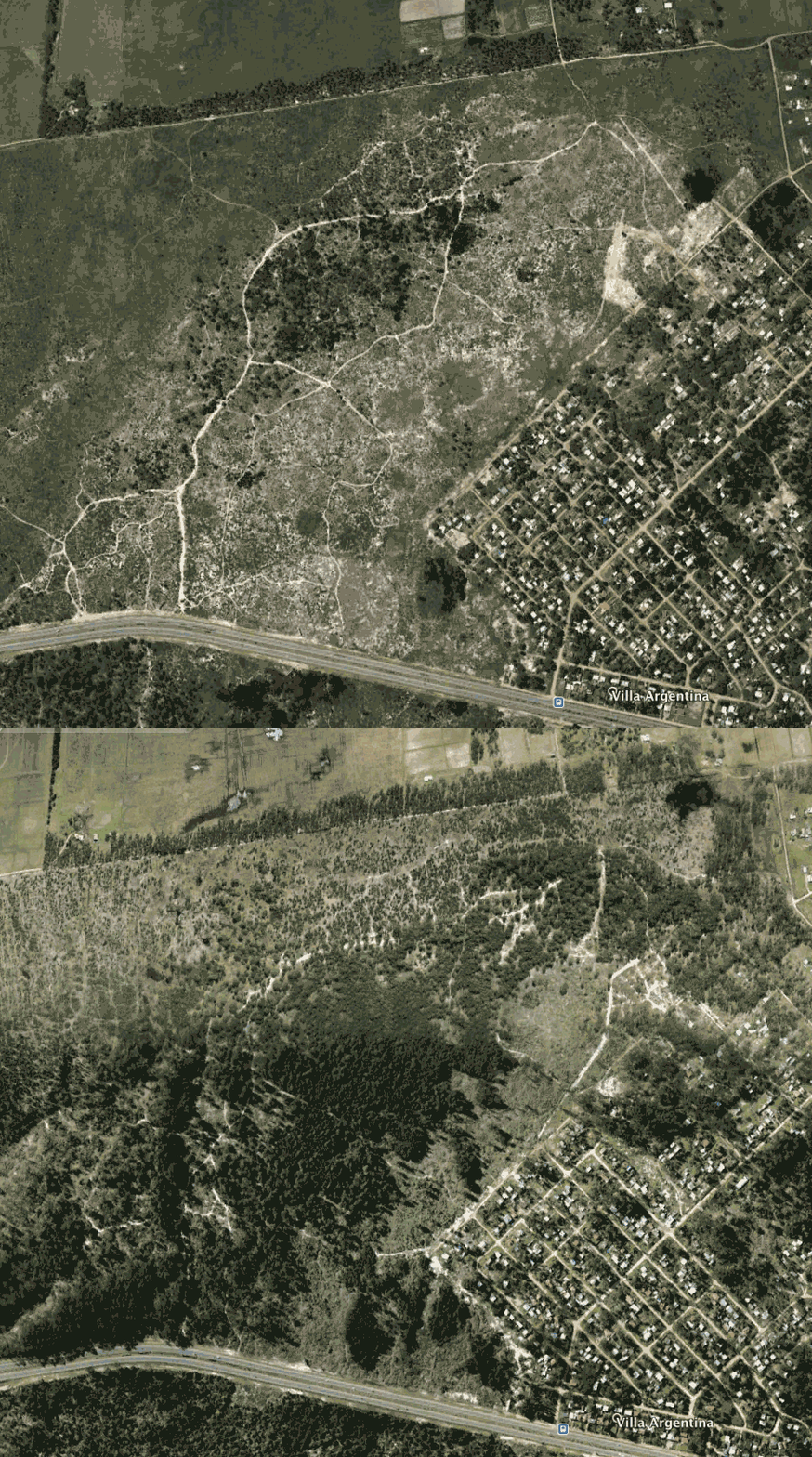
Over seven years later, when Benji and I joined Syd and dogs for walks, occasional charred stumps were the only indication that something devastating had occurred. Syd was – and still is – frequently pointing out grown-over paths that used to be a “road,” mostly for horse-drawn carts. And he has frequently told me of areas that used to be forest. I didn’t exactly not believe him, but I was amazed to consult Google/CIA Earth historical satellite imagery and see how vastly the area has changed. The wooded image is from 2006; the barren from 2014. The trees have thickened a bit since then. When stuff grows here, it tends to grow like crazy, but unfortunately the “loggers” of firewood here now do their best to prevent any trees from growing to maturity. We have no idea who the land belongs to.

It’s a lovely area to walk dogs – though not without issues: cows, bees (we were inexplicably attacked near hives we know about yesterday), horses which Mocha hasn’t yet learned to “live and let live,” motorbikes and quads, which happily Mocha ignores, unlike Benji, who went crazy chasing them.
But it’s also for the most part brush. Not particularly interesting. I look at how it was, and can only think it must have been almost magical, compared to now.
Don’t it always seem to go ….
